

-30%
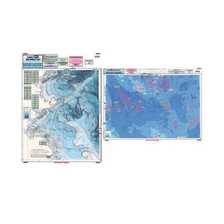
Captain Segull’s Bathymetric Massachusetts And Cashes Ledge Nautical Sportfishing Chart
Original price was: $19.99.$13.99Current price is: $13.99.
- Free Shipping over $25
- Multiple payment options for secure shopping with SSL
- Fast reliable delivery options
- Protecting Your Payment Information

Catch more fish with Captain Segull’s Charts, designed for the serious sport fisherman.
Side A of this double-sided chart displays the Isle of Shoals, New Hampshire to Duxbury Beach, MA, east to Wildcat Knoll with Stellwagen Bank. Side B shows Wildcat Knoll to Wright Swell, north to Cashes Ledge to Franklin Swell. The chart includes GPS coordinates, wrecks, reefs, shoals, fishing areas, amenities and restrictions. You should use this chart in conjunction with Captain Segull’s NOAA based charts.
- Massachusetts Bay area
- Color contoured by depth
- Full color
- Laminated
- Waterproof
- Dimensions: 19″H x 26″W
- Made in USA
Be the first to review “Captain Segull’s Bathymetric Massachusetts And Cashes Ledge Nautical Sportfishing Chart”
Related products
-30%
Original price was: $52.99.$37.09Current price is: $37.09.
-55%
Original price was: $219.99.$97.99Current price is: $97.99.
-30%


Original price was: $39.99.$27.99Current price is: $27.99.
-30%

Original price was: $49.99.$34.99Current price is: $34.99.
-30%

Original price was: $29.99.$20.99Current price is: $20.99.
-30%

Original price was: $29.95.$20.97Current price is: $20.97.
-30%
Original price was: $23.99.$16.79Current price is: $16.79.
-30%
Original price was: $132.99.$93.09Current price is: $93.09.
Reviews
There are no reviews yet.