


-30%
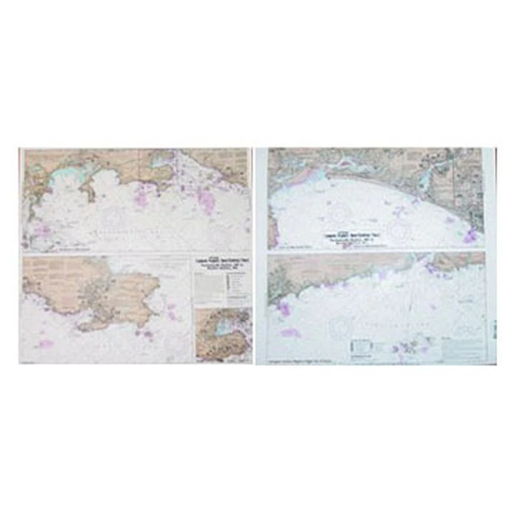
Captain Segull’s Inshore: Portsmouth Harbor, NH To Boston Harbor, MA Nautical Sportfishing Chart
Original price was: $19.99.$13.99Current price is: $13.99.
- Free Shipping over $25
- Multiple payment options for secure shopping with SSL
- Fast reliable delivery options
- Protecting Your Payment Information

Catch more fish with Captain Segull’s Charts, designed for the serious sport fisherman.
This chart provides detail of the bays from Portsmouth Harbor, NH to Boston Harbor, MA. It includes detailing the Isle of Shoals and well as GPS coordinates, wrecks, reefs, shoals, fishing areas, amenities. restrictions and more.
- Inshore 1-2 miles off the coast, from Portsmouth to Boston Harbors
- Full color
- Laminated
- Waterproof
- Dimensions: 19″H x 26″W
- Made in USA
Be the first to review “Captain Segull’s Inshore: Portsmouth Harbor, NH To Boston Harbor, MA Nautical Sportfishing Chart”
Related products
-30%

Original price was: $27.99.$19.59Current price is: $19.59.
-30%

Original price was: $39.99.$27.99Current price is: $27.99.
-30%


Original price was: $24.00.$16.80Current price is: $16.80.
-30%
Original price was: $24.99.$17.49Current price is: $17.49.
-30%
Original price was: $132.99.$93.09Current price is: $93.09.
-30%

Original price was: $26.99.$18.89Current price is: $18.89.
-52%
Original price was: $199.99.$96.99Current price is: $96.99.
-30%
Original price was: $23.99.$16.79Current price is: $16.79.
Reviews
There are no reviews yet.