

-30%
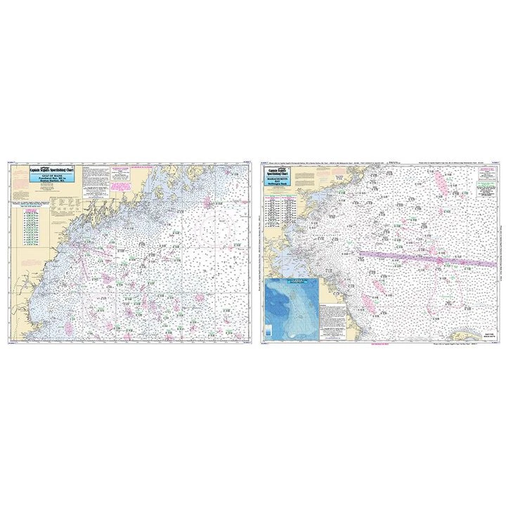
Captain Segull’s Offshore: Gulf Of Maine, Massachusetts Bay Nautical Sportfishing Chart
Original price was: $19.99.$13.99Current price is: $13.99.
- Free Shipping over $25
- Multiple payment options for secure shopping with SSL
- Fast reliable delivery options
- Protecting Your Payment Information

Catch more fish with Captain Segull’s Charts, designed for the serious sport fisherman.
A double sided chart, Side A shows the Gulf of Maine from Penobscot Bay to Boston, Massachusetts Bay and includes an inset of Portland Harbor, ME. Side B displays Massachusetts Bay, Boston south to Provincetown and Duxbury, MA and includes a bathymetric inset of Stellwagen Bank.
- Offshore chart of 90-100 miles off coast – ME, NH and MA
- Double sided
- Full color
- Laminated
- Waterproof
- Dimensions:19″H x 26″W
- Made in USA
Be the first to review “Captain Segull’s Offshore: Gulf Of Maine, Massachusetts Bay Nautical Sportfishing Chart”
Related products
-30%

Original price was: $49.99.$34.99Current price is: $34.99.
-30%

Original price was: $19.99.$13.99Current price is: $13.99.
-30%

Original price was: $24.99.$17.49Current price is: $17.49.
-55%
Original price was: $219.99.$97.99Current price is: $97.99.
-30%
Original price was: $59.99.$41.99Current price is: $41.99.
-30%

Original price was: $15.99.$11.19Current price is: $11.19.
-30%


Original price was: $24.00.$16.80Current price is: $16.80.
-30%

Original price was: $49.99.$34.99Current price is: $34.99.
Reviews
There are no reviews yet.